
Venturing into the wilderness offers unparalleled freedom and connection with nature, but the best Hiking Trail Nagivation Tools for Outdoor Enthusiasts, it also comes with significant responsibilities. Among these, knowing your location and finding your way safely tops the list. Whether you’re exploring well-marked trails or venturing off the beaten path, reliable navigation tools are essential for both safety and enjoyment. Today’s hikers have more options than ever—from traditional map and compass to sophisticated GPS devices and smartphone apps. This guide examines the best hiking trail navigation tools available, helping you choose the right option for your adventures and skill level.
Why Reliable Navigation Matters on the Trail
Even experienced hikers can become disoriented in unfamiliar terrain, especially when weather conditions change suddenly or trails become obscured. According to search and rescue organisations, getting lost is one of the most common reasons hikers require emergency assistance. Reliable navigation tools not only prevent dangerous situations but also enhance your hiking experience by allowing you to explore with confidence.
Safety First: No navigation tool is foolproof. Always carry multiple navigation methods, tell someone your plans, and be prepared to spend unexpected time outdoors. The best hiking trail navigation tools complement, not replace, basic outdoor skills.
Navigation Tools Comparison
| Navigation Tool | Accuracy | Ease of Use | Battery Life | Durability | Offline Capability | Price Range |
| Gaia GPS (App) | 4.5/5 | 4/5 | 3/5 | 3/5 | Yes (Premium) | Free/$36-60/year |
| AllTrails (App) | 4/5 | 4.5/5 | 3/5 | 3/5 | Yes (Pro) | Free/$30/year |
| Garmin GPSMAP 67 | 5/5 | 3.5/5 | 5/5 | 5/5 | Yes | $400-450 |
| Garmin inReach Mini 2 | 4.5/5 | 4/5 | 4.5/5 | 5/5 | Yes | $350-400 |
| Garmin eTrex 32x | 4.5/5 | 3.5/5 | 4/5 | 4.5/5 | Yes | $250-300 |
| OS Maps (App) | 4/5 | 4/5 | 3/5 | 3/5 | Yes (Subscription) | Free/$30/year |
| Komoot (App) | 4/5 | 4.5/5 | 3/5 | 3/5 | Yes (Premium) | Free/$60/year |
| Traditional Map & Compass | 3.5/5 | 2.5/5 | 5/5 | 4/5 | Yes | $30-100 |
Master Outdoor Navigation With Our Free Guide
Download our comprehensive trail navigation guide with step-by-step instructions for using maps, compasses, and digital tools. Perfect for beginners and experienced hikers looking to sharpen their skills. Get Your Free Guide
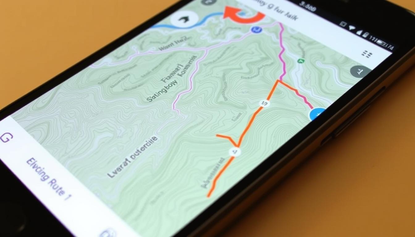
Best Smartphone Navigation Apps
Smartphone apps offer an accessible entry point into digital navigation. With powerful GPS capabilities in most modern phones, these apps can provide detailed mapping and tracking features without investing in dedicated hardware. However, they do require careful battery management and may have limitations in areas with no cell service.
Gaia GPS
4.5
Overall Rating
Accuracy
4.5/5
Ease of Use
4/5
Features
4.5/5
Gaia GPS has established itself as one of the most comprehensive navigation apps for outdoor enthusiasts. It offers detailed topographic maps, trail information, and powerful tracking features that make it suitable for everything from casual day hikes to multi-day backcountry expeditions.


Key Features:
- Downloadable maps for offline use
- Multiple map layers (topographic, satellite, NatGeo Trails Illustrated)
- Route planning and recording
- Detailed terrain information
- Weather forecast overlays
- Cross-platform synchronization
Pros
- Extensive map collection
- Powerful route planning tools
- Excellent offline functionality
- Regular updates and improvements
- Robust community features
Cons
- Premium features require a subscription
- Steeper learning curve than some alternatives
- Can drain battery quickly
Gaia GPS offers a free basic version with limited features, while the premium membership costs $39.99 annually and provides access to additional map sources, offline downloads, and advanced features. For serious hikers who regularly venture into remote areas, the premium version is well worth the investment.
Try Gaia GPS Premium
Get unlimited offline maps, advanced route planning, and real-time weather overlays with Gaia GPS Premium. Get 20% Off
AllTrails

4.3
Overall Rating
Accuracy
4/5
Ease of Use
4.5/5
Features
4.3/5
AllTrails has become one of the most popular hiking apps due to its user-friendly interface and extensive trail database. With over 200,000 trail routes worldwide, it’s particularly valuable for discovering new hiking opportunities and getting real-time trail condition updates from other users.
Key Features:
- Extensive trail database with user reviews
- Offline maps with Pro subscription
- Trail difficulty ratings and photos
- Real-time trail condition updates
- Recording and sharing capabilities
- Safety features like wrong-turn alerts
Pros
- Extremely user-friendly interface
- Massive trail database
- Helpful community reviews
- Great for discovering new trails
- Family-friendly filters
Cons
- Offline maps require Pro subscription
- Less detailed topographic information than specialised apps
- Some remote trails may not be included
AllTrails offers a free version with basic features and trail information. The Pro version costs $29.99 annually and adds offline maps, wrong-turn alerts, and more detailed map printing options. For casual hikers who primarily stick to established trails, AllTrails provides an excellent balance of usability and features.
Upgrade to AllTrails Pro
Never get lost with offline maps and real-time notifications when you wander off trail.
OS Maps

4.0
Overall Rating
Accuracy
4.3/5
Ease of Use
4/5
Features
3.8/5
The official Ordnance Survey Maps app provides access to the gold standard in UK mapping. While primarily focused on British trails, it offers exceptional detail and accuracy for hikers exploring the United Kingdom’s diverse landscapes.
Key Features:
- Detailed OS 1:25k and 1:50k maps
- Offline map downloads
- Route planning and recording
- Access to thousands of pre-planned routes
- 3D route visualisation
- Integration with paper maps
Pros
- Unmatched map detail for the UK
- Simple interface
- Excellent integration with paper maps
- Good route discovery features
Cons
- Limited usefulness outside the UK
- Subscription required for premium features
- No waypoint management
OS Maps offers a free version with basic mapping and a premium subscription for £29.99 annually that provides access to detailed maps and offline downloads. For hikers in the UK, this app combines authoritative mapping with modern features to create a powerful navigation tool.
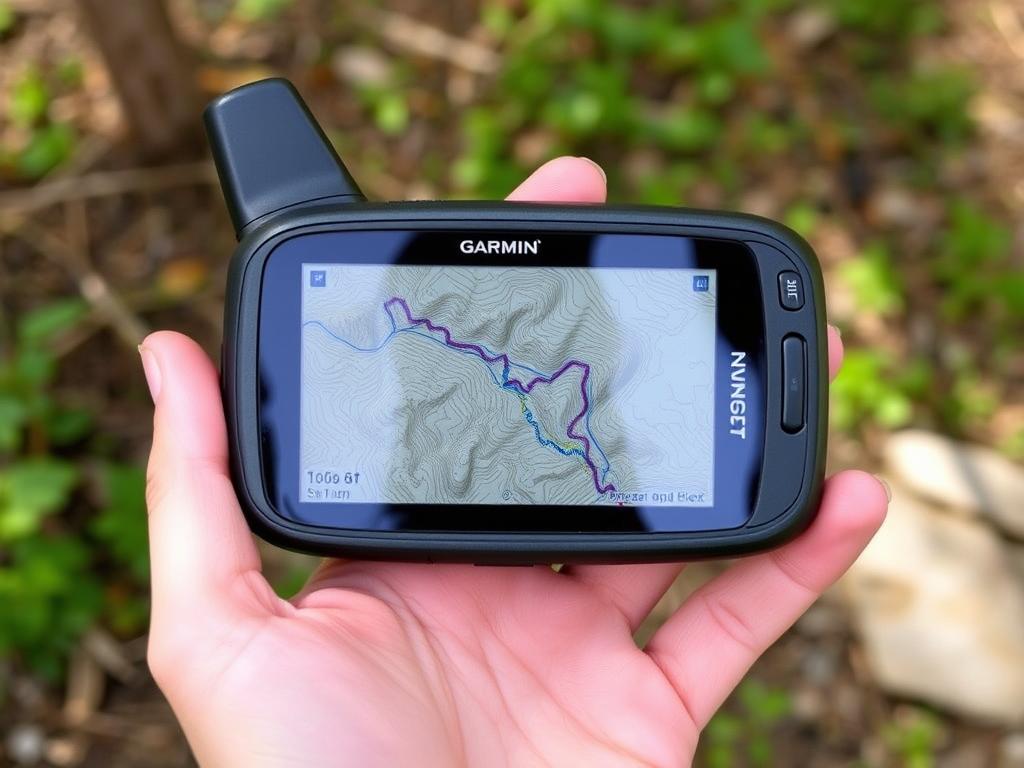
Best Dedicated GPS Devices
While smartphone apps offer convenience, dedicated GPS devices provide superior battery life, durability, and reliability in challenging conditions. These purpose-built tools are designed specifically for outdoor navigation and often include features not available on phones.
Garmin GPSMAP 67
4.8
Overall Rating
Accuracy
4.9/5
Ease of Use
4/5
Battery Life
4.8/5
The Garmin GPSMAP 67 represents the gold standard in handheld GPS devices. With its quad-helix antenna and multi-band technology, it maintains reliable satellite connections even in challenging environments like dense forests or deep canyons. The device comes preloaded with TopoActive maps for the US and Canada and offers exceptional battery performance.
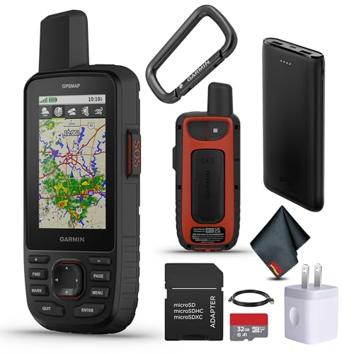

Key Features:
- Multi-band GPS technology for superior accuracy
- Up to 180 hours of battery life in GPS mode
- Preloaded topographic maps
- 16GB internal memory with microSD expansion
- Barometric altimeter and 3-axis compass
- Wireless connectivity for data sharing
Pros
- Exceptional satellite reception
- Outstanding battery life
- Durable, weather-resistant design
- Comprehensive mapping capabilities
- Reliable in extreme conditions
Cons
- Expensive investment
- Button interface has learning curve
- Bulkier than smartphone options
The Garmin GPSMAP 67 retails for around $400-450, representing a significant investment. However, for serious backcountry explorers, professional guides, or anyone venturing into remote areas regularly, its reliability and performance justify the cost. The device’s exceptional battery life and accuracy provide peace of mind that smartphone apps simply can’t match.
Get the Ultimate GPS Reliability
Navigate with confidence in the most challenging environments with the Garmin GPSMAP 67.
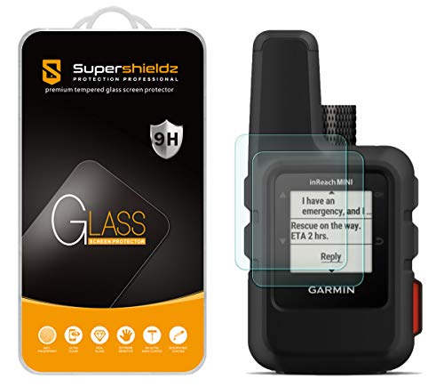
Garmin inReach Mini 2

4.6
Overall Rating
Accuracy
4.5/5
Ease of Use
4.3/5
Communication
4.8/5
The Garmin inReach Mini 2 combines satellite communication capabilities with basic GPS functionality in an incredibly compact package. Weighing just 3.5 ounces, this device allows two-way text messaging, location sharing, and emergency SOS alerts from anywhere in the world—even without cell service.


Key Features:
- Two-way satellite messaging
- Interactive SOS with 24/7 monitoring
- Location tracking and sharing
- Weather forecasts via satellite
- Up to 14 days of battery life
- Pairs with smartphones for enhanced mapping
Pros
- Ultra-compact and lightweight
- Global communication capability
- Excellent battery performance
- Potentially life-saving SOS function
- Weather updates anywhere
Cons
- Requires a subscription for satellite services
- Limited navigation features compared to dedicated GPS
- Small screen size
The inReach Mini 2 costs around $350-400, plus a monthly subscription for satellite services (starting at $14.95/month with annual plan). While primarily a communication device, its basic navigation capabilities make it a valuable companion for hikers who prioritise safety and want the ability to call for help in emergencies.
Stay Connected Anywhere
Never be out of touch with the compact Garmin inReach Mini 2 – navigation and global communication in your pocket.View Pricing Options
Garmin eTrex 32x

4.3
Overall Rating
Accuracy
4.3/5
Ease of Use
3.8/5
Value
4.5/5
The Garmin eTrex 32x offers a compelling balance of performance and affordability in a compact package. This rugged handheld GPS provides reliable navigation capabilities at roughly half the price of premium models, making it an excellent option for hikers who want dedicated GPS reliability without breaking the bank.
Key Features:
Venturing into the wilderness offers unparalleled freedom and connection with nature, but it also comes with significant responsibilities. Among these, knowing your location and finding your way safely tops the list. Whether you’re exploring well-marked trails or venturing off the beaten path, reliable navigation tools are essential for both safety and enjoyment. Today’s hikers have more options than ever—from traditional map and compass to sophisticated GPS devices and smartphone apps. This guide examines the best hiking trail navigation tools available, helping you choose the right option for your adventures and skill level.
Why Reliable Navigation Matters on the Trail
Even experienced hikers can become disoriented in unfamiliar terrain, especially when weather conditions change suddenly or trails become obscured. According to search and rescue organisations, getting lost is one of the most common reasons hikers require emergency assistance. Reliable navigation tools not only prevent dangerous situations but also enhance your hiking experience by allowing you to explore with confidence.
Safety First: No navigation tool is foolproof. Always carry multiple navigation methods, tell someone your plans, and be prepared to spend unexpected time outdoors. The best hiking trail navigation tools complement—not replace—basic outdoor skills.
Navigation Tools Comparison
| Navigation Tool | Accuracy | Ease of Use | Battery Life | Durability | Offline Capability | Price Range |
| Gaia GPS (App) | 4.5/5 | 4/5 | 3/5 | 3/5 | Yes (Premium) | Free/$36-60/year |
| AllTrails (App) | 4/5 | 4.5/5 | 3/5 | 3/5 | Yes (Pro) | Free/$30/year |
| Garmin GPSMAP 67 | 5/5 | 3.5/5 | 5/5 | 5/5 | Yes | $400-450 |
| Garmin inReach Mini 2 | 4.5/5 | 4/5 | 4.5/5 | 5/5 | Yes | $350-400 |
| Garmin eTrex 32x | 4.5/5 | 3.5/5 | 4/5 | 4.5/5 | Yes | $250-300 |
| OS Maps (App) | 4/5 | 4/5 | 3/5 | 3/5 | Yes (Subscription) | Free/$30/year |
| Komoot (App) | 4/5 | 4.5/5 | 3/5 | 3/5 | Yes (Premium) | Free/$60/year |
| Traditional Map & Compass | 3.5/5 | 2.5/5 | 5/5 | 4/5 | Yes | $30-100 |
Master Outdoor Navigation With Our Free Guide
Download our comprehensive trail navigation guide with step-by-step instructions for using maps, compasses, and digital tools. Perfect for beginners and experienced hikers looking to sharpen their skills.
Best Smartphone Navigation Apps
Smartphone apps offer an accessible entry point into digital navigation. With powerful GPS capabilities in most modern phones, these apps can provide detailed mapping and tracking features without investing in dedicated hardware. However, they do require careful battery management and may have limitations in areas with no cell service.
Gaia GPS
4.5
Overall Rating
Accuracy
4.5/5
Ease of Use
4/5
Features
4.5/5
Gaia GPS has established itself as one of the most comprehensive navigation apps for outdoor enthusiasts. It offers detailed topographic maps, trail information, and powerful tracking features that make it suitable for everything from casual day hikes to multi-day backcountry expeditions.
Key Features:
- Downloadable maps for offline use
- Multiple map layers (topographic, satellite, NatGeo Trails Illustrated)
- Route planning and recording
- Detailed terrain information
- Weather forecast overlays
- Cross-platform synchronization
Pros
- Extensive map collection
- Powerful route planning tools
- Excellent offline functionality
- Regular updates and improvements
- Robust community features
Cons
- Premium features require subscription
- Steeper learning curve than some alternatives
- Can drain battery quickly
Gaia GPS offers a free basic version with limited features, while the premium membership costs $39.99 annually and provides access to additional map sources, offline downloads, and advanced features. For serious hikers who regularly venture into remote areas, the premium version is well worth the investment.
Try Gaia GPS Premium
Get unlimited offline maps, advanced route planning, and real-time weather overlays with Gaia GPS Premium.Get 20% Off Premium
AllTrails
4.3
Overall Rating
Accuracy
4/5
Ease of Use
4.5/5
Features
4.3/5
AllTrails has become one of the most popular hiking apps due to its user-friendly interface and extensive trail database. With over 200,000 trail routes worldwide, it’s particularly valuable for discovering new hiking opportunities and getting real-time trail condition updates from other users.
Key Features:
- Extensive trail database with user reviews
- Offline maps with Pro subscription
- Trail difficulty ratings and photos
- Real-time trail condition updates
- Recording and sharing capabilities
- Safety features like wrong-turn alerts
Pros
- Extremely user-friendly interface
- Massive trail database
- Helpful community reviews
- Great for discovering new trails
- Family-friendly filters
Cons
- Offline maps require Pro subscription
- Less detailed topographic information than specialised apps
- Some remote trails may not be included
AllTrails offers a free version with basic features and trail information. The Pro version costs $29.99 annually and adds offline maps, wrong-turn alerts, and more detailed map printing options. For casual hikers who primarily stick to established trails, AllTrails provides an excellent balance of usability and features.
Upgrade to AllTrails Pro
Never get lost with offline maps and real-time notifications when you wander off trail.Try AllTrails Pro
OS Maps
4.0
Overall Rating
Accuracy
4.3/5
Ease of Use
4/5
Features
3.8/5
The official Ordnance Survey Maps app provides access to the gold standard in UK mapping. While primarily focused on British trails, it offers exceptional detail and accuracy for hikers exploring the United Kingdom’s diverse landscapes.
Key Features:
- Detailed OS 1:25k and 1:50k maps
- Offline map downloads
- Route planning and recording
- Access to thousands of pre-planned routes
- 3D route visualisation
- Integration with paper maps
Pros
- Unmatched map detail for UK
- Simple interface
- Excellent integration with paper maps
- Good route discovery features
Cons
- Limited usefulness outside the UK
- Subscription required for premium features
- No waypoint management
OS Maps offers a free version with basic mapping and a premium subscription for £29.99 annually that provides access to detailed maps and offline downloads. For hikers in the UK, this app combines authoritative mapping with modern features to create a powerful navigation tool.
Best Dedicated GPS Devices
While smartphone apps offer convenience, dedicated GPS devices provide superior battery life, durability, and reliability in challenging conditions. These purpose-built tools are designed specifically for outdoor navigation and often include features not available on phones.
Garmin GPSMAP 67
4.8
Overall Rating
Accuracy
4.9/5
Ease of Use
4/5
Battery Life
4.8/5
The Garmin GPSMAP 67 represents the gold standard in handheld GPS devices. With its quad-helix antenna and multi-band technology, it maintains reliable satellite connections even in challenging environments like dense forests or deep canyons. The device comes preloaded with TopoActive maps for the US and Canada and offers exceptional battery performance.
Key Features:
- Multi-band GPS technology for superior accuracy
- Up to 180 hours of battery life in GPS mode
- Preloaded topographic maps
- 16GB internal memory with microSD expansion
- Barometric altimeter and 3-axis compass
- Wireless connectivity for data sharing
Pros
- Exceptional satellite reception
- Outstanding battery life
- Durable, weather-resistant design
- Comprehensive mapping capabilities
- Reliable in extreme conditions
Cons
- Expensive investment
- Button interface has learning curve
- Bulkier than smartphone options
The Garmin GPSMAP 67 retails for around $400-450, representing a significant investment. However, for serious backcountry explorers, professional guides, or anyone venturing into remote areas regularly, its reliability and performance justify the cost. The device’s exceptional battery life and accuracy provide peace of mind that smartphone apps simply can’t match.
Get the Ultimate GPS Reliability
Navigate with confidence in the most challenging environments with the Garmin GPSMAP 67.
Garmin inReach Mini 2
4.6
Overall Rating
Accuracy
4.5/5
Ease of Use
4.3/5
Communication
4.8/5
The Garmin inReach Mini 2 combines satellite communication capabilities with basic GPS functionality in an incredibly compact package. Weighing just 3.5 ounces, this device allows two-way text messaging, location sharing, and emergency SOS alerts from anywhere in the world—even without cell service.
Key Features:
- Two-way satellite messaging
- Interactive SOS with 24/7 monitoring
- Location tracking and sharing
- Weather forecasts via satellite
- Up to 14 days of battery life
- Pairs with smartphones for enhanced mapping
Pros
- Ultra-compact and lightweight
- Global communication capability
- Excellent battery performance
- Potentially life-saving SOS function
- Weather updates anywhere
Cons
- Requires subscription for satellite services
- Limited navigation features compared to dedicated GPS
- Small screen size
The inReach Mini 2 costs around $350-400, plus a monthly subscription for satellite services (starting at $14.95/month with annual plan). While primarily a communication device, its basic navigation capabilities make it a valuable companion for hikers who prioritize safety and want the ability to call for help in emergencies.
Stay Connected Anywhere
Never be out of touch with the compact Garmin inReach Mini 2 – navigation and global communication in your pocket.
Garmin eTrex 32x
4.3
Overall Rating
Accuracy
4.3/5
Ease of Use
3.8/5
Value
4.5/5
The Garmin eTrex 32x
- 2.2-inch sunlight-readable color display
- Preloaded TopoActive maps
- 8GB internal memory with microSD expansion
- Barometric altimeter and 3-axis compass
- 25 hours of battery life on two AA batteries
- Compact and lightweight design (5.6 oz)
Pros
- Excellent value for money
- Compact and lightweight
- Good satellite reception
- Uses readily available AA batteries
- Durable construction
Cons
- Smaller screen than premium models
- Button interface can be tedious
- Shorter battery life than newer models
The eTrex 32x typically retails for $250-300, making it significantly more affordable than premium GPS units while still offering core navigation features. For weekend hikers, budget-conscious adventurers, or those looking for a reliable backup device, the eTrex 32x provides excellent performance at a reasonable price point.
Reliable Navigation on a Budget
Get dedicated GPS reliability without the premium price tag with the compact Garmin eTrex 32x.
Traditional Navigation Tools
Despite technological advances, traditional navigation tools remain essential skills for any serious hiker. These methods don’t require batteries, are immune to water damage (with proper protection), and develop fundamental navigation skills that enhance your understanding of terrain.
Map and Compass

4.0
Overall Rating
Reliability
4.8/5
Ease of Use
3/5
Versatility
4.3/5
The combination of a quality topographic map and baseplate compass remains the foundation of wilderness navigation. While requiring more skill than digital alternatives, this method provides a deeper understanding of terrain and develops navigation abilities that serve as an essential backup when technology fails.
Key Components:
- Topographic map of your hiking area
- Baseplate compass with declination adjustment
- Map case or waterproof map
- Knowledge of basic navigation techniques
Pros
- No batteries required
- Highly reliable when used properly
- Develops fundamental navigation skills
- Provides broad area overview
- Lightweight and durable
Cons
- Requires practice and skill development
- No real-time position tracking
- Can be challenging in poor visibility
A quality baseplate compass costs $25-60, while topographic maps typically range from $10-15 each. While the initial learning curve is steeper than digital options, the skills developed through map and compass navigation provide a foundation that enhances all outdoor experiences and serves as an essential backup when technology fails.
Pro Tip: Even if you primarily use digital navigation tools, always carry a map and compass as backup. Take a basic navigation course to develop essential skills that could be life-saving in an emergency.
The Hybrid Approach: Combining Digital and Traditional Tools

For most hikers, the optimal approach combines digital convenience with traditional reliability. Modern navigation typically involves using a smartphone app or GPS as your primary tool while carrying a map and compass as backup. This redundancy ensures you’re prepared for technology failures while benefiting from the precision and convenience of digital navigation.
Recommended Hybrid Setup
Primary Navigation
- Smartphone with navigation app (Gaia GPS or AllTrails)
- Portable battery pack for extended trips
- Protective case and screen protector
- Downloaded offline maps for your route
Backup Navigation
- Waterproof topographic map of your area
- Quality baseplate compass
- Small notebook and pencil
- Basic navigation knowledge
Navigation Best Practice: Before starting your hike, study your route on both digital and paper maps. Identify key landmarks, potential hazards, and bailout options. Mark waypoints at critical junctions and share your planned route with someone who’s not on the trip.
Never Get Lost Again: Free Navigation Guide
Our comprehensive 25-page guide covers everything from basic map reading to advanced GPS techniques. Download it now to build confidence on any trail.
Frequently Asked Questions About Hiking Navigation
Can I rely solely on my smartphone for trail navigation?
While modern smartphones have powerful GPS capabilities, relying solely on them isn’t recommended for several reasons. Battery life is limited, especially in cold weather or when using GPS continuously. Phones are also vulnerable to damage from drops, water, or extreme temperatures. Additionally, many wilderness areas have no cell service, requiring pre-downloaded maps. For day hikes on well-marked trails in popular areas, a smartphone with a navigation app may be sufficient, but always carry a backup power bank and consider a paper map for longer or more remote hikes.
What’s the difference between GPS and GLONASS satellite systems?
GPS (Global Positioning System) is operated by the United States, while GLONASS is Russia’s equivalent system. Modern navigation devices often use both systems simultaneously, along with other networks like Europe’s Galileo and China’s BeiDou. Using multiple satellite systems improves accuracy and reliability, especially in challenging environments like deep canyons or dense forests. Devices that can access multiple satellite networks generally provide better performance than those limited to a single system.
How accurate are hiking GPS devices?
Most modern hiking GPS devices and smartphone apps can achieve accuracy within 10-30 feet (3-9 meters) under ideal conditions. Dedicated GPS units with multi-band technology and access to multiple satellite networks, like the Garmin GPSMAP 67, can achieve accuracy within 3-10 feet (1-3 meters). Accuracy can be affected by terrain (canyons, dense forest), weather conditions, and satellite availability. For most hiking purposes, this level of accuracy is more than sufficient, though it’s important to understand that no GPS is perfect and errors can occur.
Do I need to know how to use a map and compass if I have a GPS?
Yes, basic map and compass skills remain essential for any serious hiker. Electronic devices can fail due to battery depletion, water damage, or technical issues. Understanding how to read topographic maps, take bearings, and navigate with a compass provides a reliable backup method and deepens your understanding of the landscape. These fundamental skills enhance your overall navigation abilities and confidence in the backcountry, even when primarily using digital tools.
What’s the best way to preserve battery life when using GPS navigation?
To maximize battery life when using GPS navigation:
- Download maps for offline use before your trip
- Put your device in airplane mode (GPS still works)
- Reduce screen brightness
- Turn off unnecessary features and apps
- Keep your device warm in cold weather (inside pockets)
- Use power-saving modes when available
- Consider carrying a portable battery pack for longer trips
- Turn off GPS tracking when stopped for extended periods
These strategies can significantly extend battery life, especially on multi-day adventures.
Recommendations for Different Hiker Types
For Beginners
If you’re new to hiking or primarily stick to well-marked trails:
- Primary: AllTrails Pro app
- Backup: Basic map of the area
- Why: User-friendly interface, trail reviews, and clear navigation make AllTrails ideal for newcomers. The social features help you find appropriate trails for your skill level.
For Weekend Warriors
For regular hikers who occasionally venture off-trail:
- Primary: Gaia GPS Premium
- Backup: Topographic map and compass
- Why: Gaia offers more detailed mapping and planning features than basic apps, supporting more adventurous exploration while remaining user-friendly.
For Backcountry Explorers
For serious hikers who regularly venture into remote areas:
- Primary: Garmin GPSMAP 67 or inReach Mini 2
- Secondary: Gaia GPS Premium
- Backup: Detailed topographic maps and quality compass
- Why: Remote adventures demand reliable equipment with long battery life and potentially life-saving communication capabilities.

Conclusion: Finding Your Way Forward
The best hiking trail navigation tools combine reliability, ease of use, and appropriate features for your specific needs. For most hikers, a combination approach works best—using digital tools for convenience and precision while maintaining traditional navigation skills as backup. Whether you choose a smartphone app, dedicated GPS device, traditional map and compass, or a combination of these, the most important factor is familiarity with your tools before you need them in the field.
As technology continues to evolve, navigation tools will become even more powerful and user-friendly. However, the fundamentals remain unchanged: preparation, awareness, and redundancy are the keys to safe navigation in the wilderness. Invest time in learning proper navigation techniques, practice regularly, and always carry backup methods. With the right tools and skills, you can explore with confidence, knowing you can always find your way back.